

What Our Spatial Stack Is For
The same foundational technologies power every service below — from a real-estate tour on your phone to live search and rescue detection in the field.
Real-Estate Virtual Touring
Walk a completed property in 3D from anywhere — rooms, textures and scale, built from phone and drone capture. Buyers can tour the house before a single visit. Live demo ↗
Get Quote →Plantation Growth-Stage Detection & Automated Notifications
One side of a plantation can be ready while the other isn't. Our segmentation detects growth stage and disease per zone, then sends automated event notifications — so fertilizer, medication and harvest are applied at precisely the right moment, zone by zone, not field by field.
Demo coming soon Get Quote →Live Search & Rescue Detection and Pinning
Drone-ready live-feed systems: human life is detected on the feed as it happens, and each detection is pinned in 3D space in real time — so the response team flies directly to the find, not to a guessed location.
Demo coming soon Get Quote →3D Object Detection & Labeling
Objects are detected, measured and labeled in 3D space — rooms, windows, vehicles, crops, structures — each with a stable identity that teams, dashboards and APIs can query and track over time.
Demo coming soon Get Quote →Construction Monitoring & Material Quantification
Progress measured from the air, week over week: material tonnage by pile, floor by floor, milestones compared to quoted usage — so underdelivery is visible before it becomes a dispute.
Live demo ↗ Get Quote →Design Iteration with Compliance Guardrails
Drone topo and hyper-detailed 3D from site mapping form the base. Flooding is simulated with full 3D fluid-dynamics stress on the infrastructure and buildings — and drainage bottlenecks are iterated away in the digital twin before anything is spent on the ground.
Demo coming soon Get Quote →Live 3D Scene Reconstruction
Phone and drone capture rebuilt into real-time 3D environments you can walk, measure and compare. It is computationally expensive, so for now it is used exclusively in search and rescue pinning and evac path planning.
Live demo ↗ Get Quote →Agentic Control & AI Interaction
An interactive UI with AI that controls and manipulates the 3D environment in real time — ask where to go, request measurements, steer the camera, and let the agent act on the scene.
Demo coming soon Get Quote →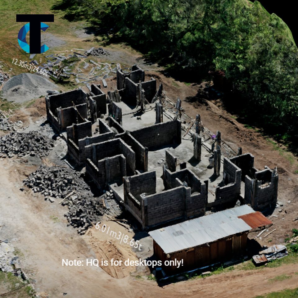
From the air
Every Service Starts With the Same Capture
The same foundational capture feeds real-estate tours, plantation segmentation, construction quantification and search-and-rescue — one engine, many services.